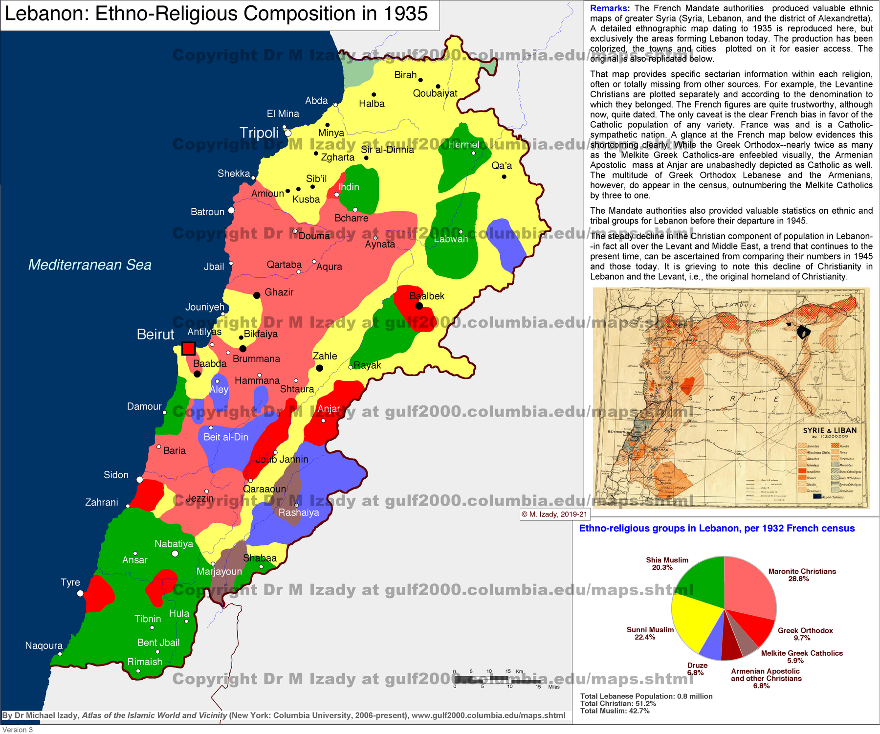
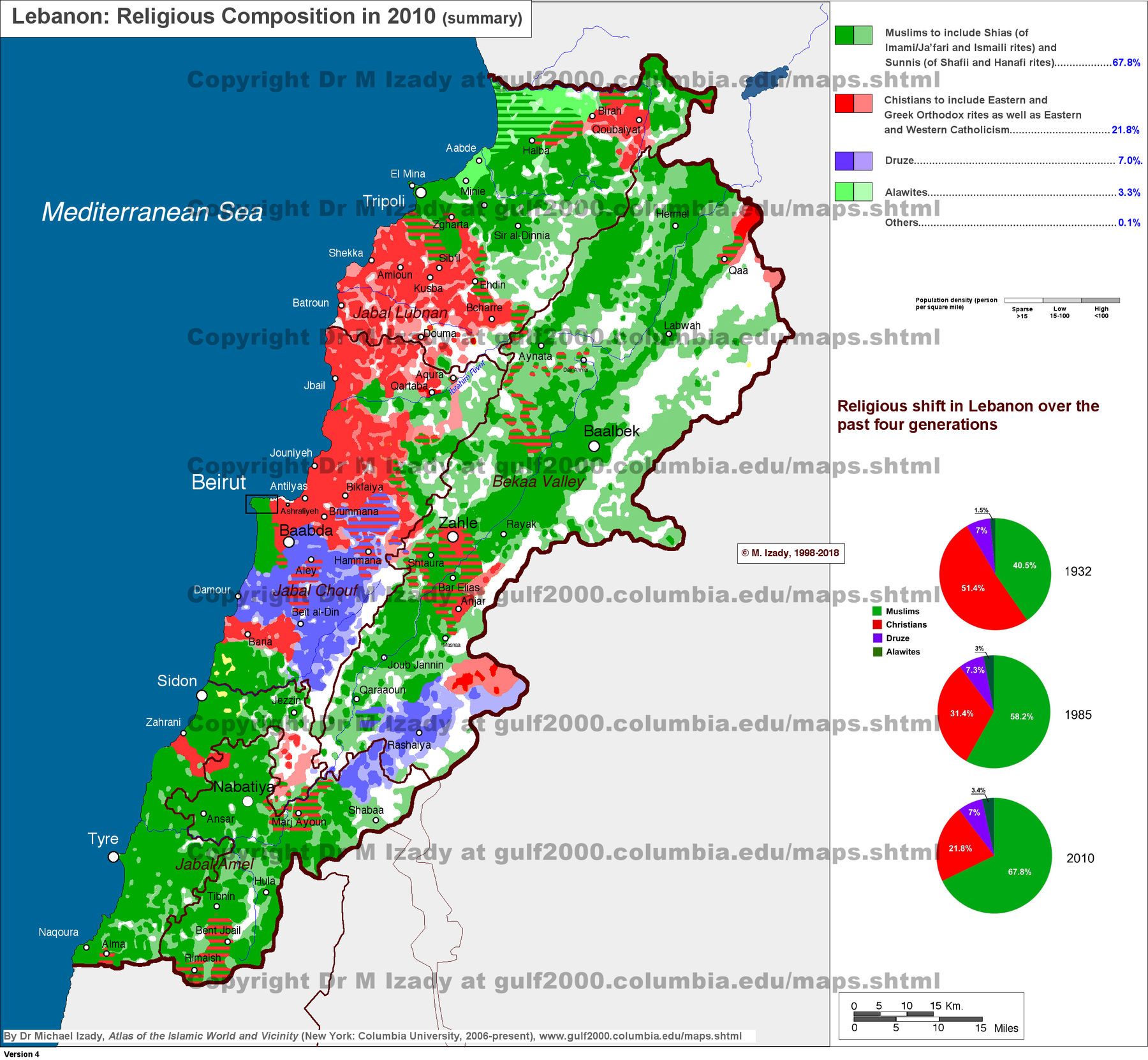
These are Izady’s geographic reconstructions and estimates, not a uniform census series or maps of political allegiance. Dates and classifications belong to each image; religious affiliation does not establish support for a government or armed group.
Communities in 1935
A reconstruction of the 1935 distribution, with a French Mandate map and census material reproduced within the image. Useful before the discussion of Greater Lebanon and confessional power-sharing; it is not a present-day demographic map.
Map source: Dr. Michael Izady, Gulf/2000, Columbia University. Original map · Collection. Personal reference use; copyright remains with the author.
Religious geography in 2010
The image identifies its geographic snapshot as 2010 and includes historical comparison charts. Use it for settlement geography; it is not an updated 2026 population estimate or a map of Hezbollah support.
Map source: Dr. Michael Izady, Gulf/2000, Columbia University. Original map · Collection. Personal reference use; copyright remains with the author.